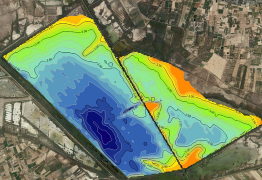
The bathymetry is the underwater equivalent of the altimetry, it is the study of the depths of the lake or marine bottoms and it serves to know the cartography of the surface of a lake, reservoir or a river, which is covered with water so we cannot proceed with the same methods that we use in the terrestrial surface and this is the way we will know their forms, volumes and characterization of such water body.
Methodology
The data used today for the construction of bathymetric maps usually comes from an echo sounder mounted under the keel or on the side of a boat, releasing a sound wave towards the bottom of the body of water. The amount of time it takes for the sound to go through the water, bounce at the bottom and back, informs to the echo sounder of the actual depth.
Today can be used a wide-sweeping sonar, consisting of dozens of simultaneous waves, very narrow and adjacent to each other, forming a range of between 90 and 180 degrees.

